Ocean 260 Lab Page

Ocean 260, section B Materials and Readings
The LAB Section of 260 is intended to acquaint you with the "details" of Puget Sound - where the rivers are, how water moves in them as function of the landscape and end up in the Sound, then how the Sound works. The Lab has two types of activities:
* Computer labs, where the principles of GIS and computer modeling are used to "explore" the Sound. The Lab sessions will be held in SAL computer room, OSB 111. Computer labs will range in length from 2 hours to the full 4 hour timeblock
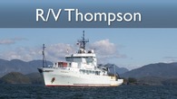
* Field trips, to "see" what we are talking about in the classroom and on the computer. Field trips will typically fill the entire 4 hour time block. Of special note is a trip on the School of Oceanography's R/V Thompson, a world-class research vessel (note: this will tentatively be an overnight trip - please plan accordingly).
Lab 1: Google Earth Pro and the Puget Sound Watershed
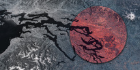
During the course of the quarter the instructors hope to familiarize you to several different visualization systems for observing geographic information. In Lab 1, Google Earth Pro will be utilized to introduce students to some of the basic geography of Puget Sound, as well as some of the different types of data that can be presented by means of the Google Earth platform. We will also introduce some of devices and techniques that are used to acquire the data that is used to create the layers we will be observing.
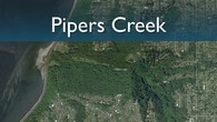
Field Trip 1: Pipers Creek
On Tuesday, October 12, we will meet workers from EarthCorp (formerly SUN), a community group, at Piper's Creek in northwest Seattle to see how vegetation surveys are performed. The purpose is to see one example of how the kinds of data used in GIS maps (such as those we looked at last week in the Google Earth lab) and models (such as DHSVM, which we study later in the quarter) are gathered. This experience should give you a better picture of the kinds of compromises that are made to compose maps and build environmental simulation models.
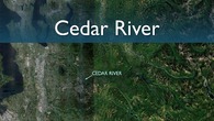
Field Trip 2: Cedar River
On Tuesday, October 19, we will visit sites along the lower Cedar River, from Renton to Maple Valley. This field trip will visit a number of sites that exemplify the ecological restoration strategy of focusing on restoration of natural processes (such as channel movement across a floodplain) rather than the achievement of fixed conditions at a specific site.
Field Trip 3: RV Thompson
An overnight cruise on the UW research vessel Thomas G. Thompson is planned for October 26th, 2010. The tentative schedule is to depart during regular lab hours (12:30) on Tuesday and return early in the morning (6-7 am) on Wednesday.
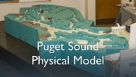
Lab 2: Puget Sound Physical Model
During this lab session we will look at two physical Puget Sound models, built here at the University of Washington. One model displays the basics of estuarine water circulation. The second is a to-scale representation of the Puget Sound basin, which is capable of predicting the movement of water throughout the basin. These types of physical models are the predecessors of more sophisticated computer models that will be explored in future lab exercises.
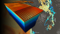
Lab 3: Visual Puget Sound Model
During this lab exercise we will explore a computerized model of the Puget Sound Basin. We will use the Collaborative Ocean Visualization Environment (COVE), which is being developed at UW, to visualize various oceanographic datasets. We will explore oceanographic properties in Puget Sound such as temperature, salinity and circulation. The interface allows you to choose a wide range of views of simulated data that were generated previously by another model.
Lab 4: Historical Changes to Duwamish, Cedar, and Black Rivers visulaed with COVE
This computer laboratory takes students through the history of human alteration of the lower Duwamish River and the neighboring Black and Cedar Rivers. In the past 150 years, dramatic changes have taken place to these rivers and Duwamish estuary as urban areas including dense population and industrial sites have been built along waterways.
Lab 5: Applying the Distributed Hydrology Soil-Vegetation Model (DHSVM) to Big Beef Creek
This computer lab exercise will explore the application of cutting edge watershed basin models. The Distributed Hydrology Soil Vegetation Model (DHSVM), developed at UW, is a computerized modeling environment that reconstructs the topography, soil, and vegetative properties of a watershed. Using precipitation data, DHSVM is capable of accurately depicting the flow of water throughout a basin, and can also be used to predict the effects of changes in land use and watershed properties.
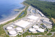
Field Trip 4: West Point Wastewater Treatment Plant
For our Grand Finale, we will track the water that goes through the “human” engineering of pipes and treatment plants, to the Sound, by visiting the West Point treatment plan.
Lab 6: SHIRAZ
Today we will be learning about SHIRAZ (Salmon Habitat Integrated Resource Analysis: Zowie!), a salmon life-cycle model that incorporates anthropogenic effects into fish-habitat relationships. SHIRAZ was developed under the supervision of UW Fisheries Professor Ray Hilborn. The model allows for future projections of salmon population sizes as affected by habitat variables that are discussed below.
