ORCA Data Collection
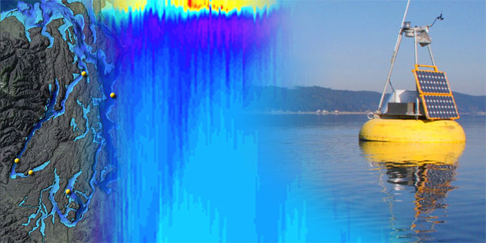
ORCA buoys provide multiple real-time data sources to help understand dissolved oxygen problems in southern Hood Canal
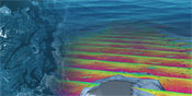
The Oceanic Remote Chemical Analyzer (ORCA) is an autonomous moored profiling system that provides real-time data streams of water and atmospheric conditions. It consists of a profiling underwater sensor package with a variety of chemical and optical sensors, and a surface mounted weather station, solar power system, winch, and custom computer and software package equipped with WIFI/cellular communication.
Since its deployment in 2000, the ORCA system has provided a near-continual stream of high-resolution water quality data from locations in Puget Sound. It was first deployed in South Puget Sound (Carr Inlet) to monitor water quality in an area with potential sensitivity to eutrophication and urban growth. After 3 years, the ORCA mooring was relocated to the main basin of Puget Sound to collect data for siting King County's Brightwater [hyperlink to PRISM story] sewage outfall pipe near Point Wells.
In 2005, the buoy was moved to the southern end of Hood Canal as part of the Hood Canal Dissolved Oxygen Program. This mooring, and 3 additional ORCA moorings deployed throughout the canal, provide real-time water quality parameters to the effort to quantify and understand the seasonal hypoxia in southern Hood Canal.
Development of the original ORCA mooring was funded mainly by the U.S. EPA and NASA, with partial support from PRISM. Subsequently, the deployment in the main Basin of Puget Sound was supported by King County and PRISM. Current operations in Hood Canal are supported primarily by the U.S. Navy with additional support provided by NANOOS,[hyperlink to PRISM story] PRISM and the U.S. National Science Foundation.