Finding Sea Level
Integrating terrestrial elevation and marine bathymetry
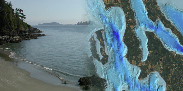
Imagine you are walking along a Puget Sound beach. To your left, a Washington State Ferry cruises over the depths of the Sound, while to your right a tree lined bluff rises to a prominent overlook. Determining the height of the bluff and the depth of the water requires starting from a known and agreed upon zero elevation reference point. For navigation purposes, the marine community places zero at the lowest extent of low tide insuring that at all times ship traffic is informed about shallow water conditions. To insure that our roads, bridges, and homes are well above the influence of floods and tides, land surveys have long recorded their elevations relative to a zero at the highest extent of high tide.
These two diverse perspectives for expressing the location of sea level challenge scientists working across the land/sea interface. The nearshore environment is one of the most diverse and dynamic ecosystems within all of Puget Sound and our measurements in that space are continuously challenged by these two reference points.
Reconciling these two perspectives became the focus of a PRISM sponsored partnership between the Departments of Earth and Space Sciences and the School of Oceanography through the graduate work of David Finlayson, PhD, 2005. By interpolating the tidal range at all tide stations throughout Puget Sound, David created a spatially explicit correction to the vertical offset of these two data types. This work enabled PRISMs Virtual Puget Sound to be built upon a seamless elevation and bathymetry model from the crest of the Cascades to the depth of the Sound.