River History
The Puget Sound River History Project is a response to the need for a better understanding of the "reference state" of rivers and estuaries to support river restoration and management in the Puget Sound area.
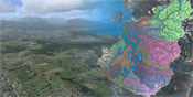
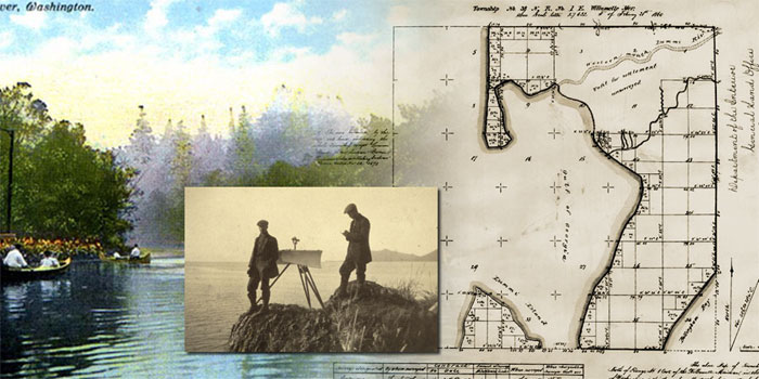
The project takes three approaches to study the processes and forms that constitute the landscape's physical template, controls on its spatial pattern, its evolution through time, and how it functions as a template for ecosystems. (1) It uses digital terrain analysis to understand how the region's geologic history and the ongoing fluvial response generates landscapes with contrasting river morphology and dynamics, floodplain landforms, and ecosystems. (2) To study the forms and spatial patterns of landscape without the obscuring and homogenizing effects of modern land use, it uses 19th century field surveys supplemented with more recent sources, including high-resolution digital elevation models from lidar, in a GIS to map land cover and landforms at the time of early Euro-American settlement. (3) It also undertakes process studies using field sites and data from archival sources to better understand landform and ecosystem dynamics, including the interactions between forests, wood, and fluvial processes and landforms. Working with PRISM, the project provides web accessible data on historical change to river and nearshore environments of Puget Sound for anyone to examine, use and analyze. It is currently developing an interactive online GIS atlas of historical landscape change for use in instruction, research, and environmental restoration and management. The River History Project is a joint effort between the Geomorphology Research Group and GIS lab in the Department of Earth and Space Sciences, PRISM, and the Quaternary Research Center.
Links:
Puget Sound River History Project
Department of Earth and Space Sciences
Geomorphological Research Group