Coastal Landcover
Satellite based coastal zone landcover classification of Puget Sound
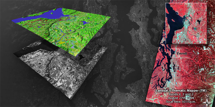
Satellite based observations of Puget Sound gained acceptance in the research community in the early 1980s with the launch of the NASA Landsat mission. Initially these satellite observations were used to monitor agricultural and urban expansion and map changes in the region's general landcover. When viewed from these space based platforms, Puget Sound basin exhibits a wide variety in land and water surfaces, which through repeated monitoring, documents important ecological change.
PRISM, in partnership with King County, initiated an undergraduate course in the application of satellite remote sensing to regional land cover mapping and planning. In a collaborative course, the Department of Urban Design and Planning, the School of Oceanography, and the School of Aquatic and Fishery Sciences worked with an interdisciplinary team of students, and along with team teaching by Dr Frank Westerlund and Dr. Miles Logsdon conducted a satellite based land cover classification of the entire Puget Sound using the Landsat Thematic Mapper data from 1998. This dataset resulted in a general classification of 32 unique types of land cover throughout the Sound and was used in the initial version of the Virtual Puget Sound's physical template.