Home | Mission | Search | News
Site Navigation
Lecture 3 Slide 18
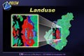
Land Use Header
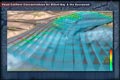
3D Planned Circulation
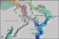
3D South Puget Sound Circulation
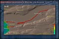
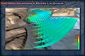
Elliott Bay Fecal Coliform Levels 3
Elliott Bay Fecal Coliform Levels 5
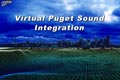
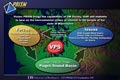
VPS Integration Header
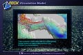
The Circulation Model - Admiralty Inlet
Elliott Bay Fecal Coliform Levels 4
Sound Circulation and Water Quality Header
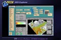
IRIS Explorer
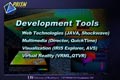
Development Tools Header
VPS Visualizations Header
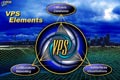
VPS Elements
The VPS Prototype 1
The VPS Cycle
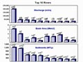
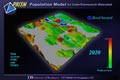
Puget Sound Flood Hazard 2020
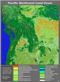
Pacific Northwest Land Cover
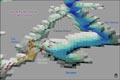
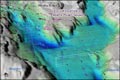
3D Circulation of North Puget Sound
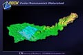
Cedar/Sammamish Watershed
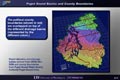
Puget Sound Basins and County Boundaries
Climate and Air Quality Header
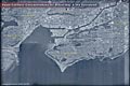
Elliott Bay Satellite Photo
Design Approach Header